
Page 8 - GIS for Science: GIS Response to COVID-19
P. 8
IMPORTANCE OF LOCATION
Esri Chief Medical Officer Este Geraghty
Location information has proven critical to decision-making associated with large outbreaks, and COVID-19 is no different. The US Centers for Disease Control (CDC) considers place to be a basic tenet of a field investigation: Both the who and the when of disease are relative to and often dependent on the where. Epidemiologists quickly turned to GIS science, systems, software (collectively known as GIS), and methods as a needed perspective to understand and track the spread of the virus. The health care community has used maps to understand the spread of disease for a long time, most famously in 1854 when Dr. John Snow connected location and illness with his history-making map of a London cholera outbreak. From disease atlases of the early twentieth century to more recent web mapping of Ebola and Zika infections, health care professionals have long considered mapping, and more recently GIS, a critical tool in tracking and combating contagion.
GIS is critical to answering many infectious disease questions:
• How quickly is the infection spreading, and where is it going?
• Do we have schools in socially vulnerable areas?
• Which neighborhoods are distant from a testing site?
• Do we have communities at a greater risk?
• Which facilities and staff are in harm’s way?
What does surveillance data on the number of hospitalizations and deaths suggest about the following questions?
• How are hospital beds and supplies distributed on a regional basis?
• How quickly are local and regional hospital resources depleted?
• Does data help predict where and how fast the pandemic will spread?
The need for location intelligence is acute when an outbreak like COVID-19 quickly spreads from a small geographic location to widespread areas. Public health officials face a major challenge, never before undertaken at this scale, of containing the outbreak through contact tracing and quarantine, which proved to be successful after the new coronavirus was identified in the city of Wuhan, China, in December 2019. For most of the world, however, health officials must evaluate and implement a series of community-level interventions to slow the spread of the illness. Health officials can use location-based information to support multiple, specific community interventions and activities. Common and helpful GIS applications include mapping and data collection apps to track cases, spread, vulnerable populations and places, and the capacity of our systems (like health care) to respond; dashboards for real- time situational awareness; and web apps for keeping the public informed. Health officials may overlay outbreak data with other location-based information, such as public gathering places, schools, health facilities and services, transportation centers, and local population demographics. GIS-supported interventions led to the implementation of many public safeguards, and GIS continues to help monitor their impact in many ways:
• Canceling public events, meetings, and gatherings
• Closing schools, public places, and office buildings
• Restricting use of public transportation systems
• Identifying potential group quarantine and isolation facilities
• Enforcing community or personal quarantines
• Screening airline passengers and assessing airline routes
Early in the crisis, public health officials began screening international airline passengers who completed a standardized health status questionnaire and had their temperatures checked for fever. Passengers stated origin and destination addresses. Subsequently, when a disease cluster was reported in another country, public health officials could better identify how many people traveled from or had visited that same location. Using GIS, public health officials applied the information collected in the questionnaire to estimate exposures and prioritize investigations. A digital solution to capture questionnaire data, including a standardized method to geographically reference each passenger’s place of origin and travel destination, can help save the public health community valuable time in understanding the transmission dynamics and potentially lessen the spread of the disease.
GIS also plays a key role in supplementing traditional contact tracing. Geographically referencing contact information allows hospitals to perform location analysis to identify places in the community at higher risk of transmission and potential points of incidental infection (when the contact is unknown). GIS can help the public health community rapidly capture standardized and geocoded addresses for confirmed cases and case contacts in an effort called Community Contact Tracing. The effort provides essential support for attempts to slow the spread of disease throughout the community by breaking those disease transmission links among people and places.
Addressing this pandemic is part of Esri’s common mission in bringing geographic science, GIS technology, and geographic thinking to every organization globally during these difficult and challenging times. ArcGIS applications such as Survey 123, StoryMaps, ArcGIS Pro, HUB, Tracker, Dashboard, and dozens of solution templates are helping people understand and tell their stories in real time. GIS application builders around the world have embraced the platform in the ongoing battle against COVID-19.
We have much more to do. Our way of living has changed, and we now need to think about what’s next. What will the workplace look like in a physically distanced world? How can we make our communities more resilient (event planning, elections, etc.)? How do we balance these important decisions around economic and public health? GIS will play a crucial role in all these inherently location-based problems.
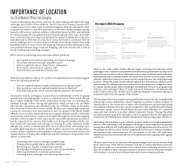
Five steps to COVID-19 response
xviii
GIS for Science
