
Page 15 - Mapping the Nation: Taking Climate Action
P. 15
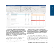
The CMRA tool gives users a national view and the ability to drill into local details, such as this analysis of extreme heat in Redlands, California. As David J. Hayes, special assistant to President Biden for climate policy, said during the annual Esri User Conference in July 2022, "There is no more important service that the federal government can provide to all Americans right now than completely up-to-date information on the climate impacts, on a geographic basis, that are hitting our communities, causing the loss of lives and loss of livelihoods." Today we have better data, better tools, and even more appetite for climate information than in years prior. We all need to do our part—and this portal can engage everyone and get leaders started with data-informed decision- making, leading to impactful interventions. Maps have sparked the imagination and offered a way of communicating and navigating for centuries. We've used maps to see beyond where we're standing—answering what or who is on the other side of that mountain range, across that sea, or beyond that horizon. Now we have high-tech maps that accurately illustrate the conditions we face today, and those we'll confront in the future. My hope is that this new online portal inspires us all to see what we face in our neighborhoods, our regions, and our nation and to take on the challenges collectively. Seeing—on a dynamic, data-rich map—brings understanding. Together, let's use that understanding to map a better future. 14 White House Portal
