
Page 155 - Mapping the Nation: Taking Climate Action
P. 155
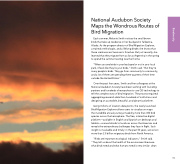
National Audubon Society Maps the Wondrous Routes of Bird Migration Each summer, Melanie Smith notices the small brown birds that take up residence in her backyard in Talkeetna, Alaska. As the program director of Bird Migration Explorer, a trained ornithologist, and a lifelong birder, she knows that these creatures are Swainson's thrushes. But just recently, she learned that they migrate from as far as Argentina in the spring to spend the summer nesting near her home. "When you see birds in your backyard or out in your local park, it feels like they're your birds," Smith said. "But they're many people's birds. They go from community to community, and a lot of them are spending three-quarters of their time outside the United States." Over the past four years, Smith and her colleagues at the National Audubon Society have been working with founding partners and hundreds of researchers to use GIS technology to tell the complex story of bird migration. The process required aggregating research data from hundreds of institutions and designing an accessible, beautiful, and dynamic platform. Using millions of location data points, the newly launched Bird Migration Explorer allows users to visualize on maps the incredible annual journeys made by more than 450 bird species across the hemisphere. The free, interactive digital platform—available in English and Spanish on desktops and tablets—connects birds to locations across the Americas and reveals the extraordinary challenges they face in flight. Such insight is invaluable and timely: in the past 50 years, we've lost more than 2.5 billion migratory birds from North America. "Birds are important ecological indicators," Smith said. "They tell us about the health of the environment because what birds need and what humans need is very similar: clean 154 Biodiversity
