
Page 32 - Mapping the Nation: Taking Climate Action
P. 32
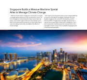
Singapore Builds a Massive Maritime Spatial Atlas to Manage Climate Change What the future holds for Singapore's coastal areas is a matter of strategic global importance and local existential survival. The Port of Singapore, located where the Indian Ocean meets the Pacific, is the world's largest and busiest transshipment point. Much of the island itself lies perilously just a few meters above sea level, making it particularly vulnerable to the effects of climate change. Until recently, technological limitations have hampered abilities to map the ocean depths and address challenges like those faced by Singapore. But, since 2019, the Maritime and Port Authority (MPA) of Singapore has managed GeoSpace-Sea, a national marine spatial data infrastructure of Singapore's coast and coastal waters. GeoSpace-Sea aims to bring clarity to this cartographic frontier, using a GIS to assemble and display layers of maritime and marine data. 31
