
Page 42 - Mapping the Nation: Taking Climate Action
P. 42
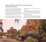
Urban Parks Play a Key Role in Curbing Inequity and Climate Impacts As the locus of most economic activity and greenhouse gas emissions, cities around the world face the escalating challenge of understanding and managing climate change. Cities are home to half the world's population, and as urbanization increases, so too will climate risk. This makes urban strategies to curb emissions all the more critical. Many of these strategies are being built around location-specific insight from data-driven maps and spatial analysis, using GIS. While cities stand out as primary contributors to climate issues, they are also the biggest victims of climate change. Most lie near coastlines or inland waters, putting them in immediate danger from rising sea levels and extreme weather events. Taking a more granular view, climate vulnerability across cities is unevenly distributed. Low-income communities suffer more than others, often for deeply rooted historical reasons. As the crisis intensifies, these urban climate inequities will too. City Smarts and Smart Cities Leaders in many major US cities are approaching climate risk and social equity issues by rethinking public parks, guided by GIS maps. To that end, the Trust for Public Land (TPL)—a San 41
