
Page 52 - Mapping the Nation: Taking Climate Action
P. 52
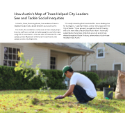
How Austin's Map of Trees Helped City Leaders See and Tackle Social Inequities In Austin, Texas, like many places, the numbers of trees in neighborhoods mark a divide between race and income. For Austin, the correlation can be seen in tree canopy maps that city staff have overlaid with demographics and other data using GIS. In west Austin—the area west of Interstate 35—tree canopy covers 78 percent of the land. In east Austin, tree canopy covers only 22 percent. "It's really interesting that Interstate 35 is also a dividing line for ecoregions," said Alan Halter, a senior GIS analyst with the City of Austin. "If you go west, you get into the Hill Country, with a lot more tree cover, but east Austin hasn't historically supported as many trees. And when you look at who lives where throughout Austin's history, communities of color have resided in east Austin." 51
