
Page 134 - Mapping the Nation: Taking Climate Action
P. 134
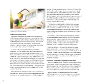
133 House-to-house assessments help homeowners know the vulnerabilities they need to address. Mapping Defensible Space Individual homeowners can protect their homes against wildfire by creating defensible space—removing flammable surface vegetation within 100 feet of their home, eliminating ladder fuels that transfer fire from the ground to taller trees, and increasing spacing within the tree canopy. Special attention is given to the zero- to five-foot zone, which is the most critical to keep a house from igniting. In Ashland, the work starts by removing flammable vegetation, such as juniper bushes, and making any wood attachments to the house, such as decks and fences, more fire resistant. Material choices for roofs and siding make a big difference, as does hardening any areas where sparks could enter a home—for example, by installing 1/8-inch metal mesh screening on crawl space and attic vents. During the Almeda Fire, many homes were spared by the initial flames, only to burn down hours or even a day later because bark mulch that was placed against the house caught fire. A new construction code in Ashland requires bark mulch to be at least five feet away from buildings. Brian Hendrix, Fire Adapted Communities coordinator for Ashland Fire & Rescue, was heavily involved in the initial data collection for the curbside inspections in Ashland and also assisted with damage assessments in Talent and Phoenix after the Almeda Fire. Drawing on those two experiences helped him understand how comparable hazards and risks in Talent and Phoenix affected structure survivability—what types of defensible space and home hardening techniques worked and what didn't based on conditions. In many instances, homes that were lost had issues identified as wildfire hazards that increase structure ignition risks. "GIS has helped track hazards in Ashland, such as excess vegetation and combustible storage near homes," Hendrix said, "and seeing post-fire remnants of those same hazards around the homes that burned confirms we've been giving residents the correct mitigation recommendations and wildfire risk warnings." It's a virtuous cycle—assessing and mapping an area with GIS before a fire helps build data that can inform mitigation efforts, response, and recovery, which then informs future mitigation efforts. Fire departments can use a geographic approach, building a map of homes and vegetation that highlights risks as a foundational step to support action. Nikki Hart-Brinkley, a GIS consultant serving the Rogue Valley, describes how a core set of data (vegetation health, building footprints, site addresses) is needed for all phases of a disaster. "If we're in resiliency building, if we're in recovery, if we're in response—it's critical to maintain these GIS resources so that we're ready to respond, and we're effective in our mitigation planning." Prioritizing Outreach and Engagement with Maps Ashland Fire & Rescue has found that the most effective way to encourage residents to harden their homes and improve defensible space has been through one-on-one engagement. When specific hazards in and around a home are identified and explained, the resident is more motivated to respond. Ashland residents can request a personalized, in-depth wildfire risk assessment from the fire department, conducted largely by trained volunteers. Because of its popularity, there
