
Page 166 - Mapping the Nation: Taking Climate Action
P. 166
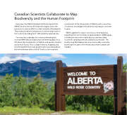
Canadian Scientists Collaborate to Map Biodiversity and the Human Footprint Every year, the Alberta Biodiversity Monitoring Institute (ABMI) sends more than 60 field technologists across the province in a massive effort to collect samples of biodiversity. They measure habitat characteristics at monitoring locations from a province-wide grid of 1,656 randomly selected sites. For more than a decade, this unique undertaking has involved ABMI field and laboratory staff entering data into a GIS about the characteristics of habitats and species of plants and animals found. This is a large inventory, mapping, and monitoring effort that many governments have talked about, but few have been able to build. Thanks to the long-term commitment of the Government of Alberta and a consortium of scientists, knowledge of biodiversity and impacts continues to grow. ABMI's appetite for data is omnivorous, encompassing everything from soil microbes to apex predators. ABMI equips its field technicians with mobile devices and trains them in scientific sampling methods and backcountry skills. The months-long field deployment may involve daily commutes by helicopter to get to the remote areas where samples are needed. 165
