
Page 87 - Mapping the Nation: Taking Climate Action
P. 87
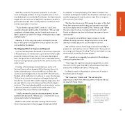
WFP then turned to Esri partner Synthetaic to solve the more challenging problem of using computer vision to find stranded people surrounded by floodwaters. Synthetaic breaks images into tiles and uses an approach that doesn't require a pretrained AI model. WFP used Synthetaic's workflow to find and rescue people in the water. "That's where our product RAIC comes in," said Corey Jaskolski, president and founder of Synthetaic. "We can take completely unlabeled data, we don't need any humans to label it, and we can search for things in the dataset by a single example query." Aided by AI in this way, responders could quickly send a boat or helicopter if the algorithm found a person in a tree surrounded by floodwaters. The Mapping Effort to Prepare and Respond Cyclone Idai displaced hundreds of thousands of people in Mozambique. Six weeks later, Cyclone Kenneth brought powerful winds and heavy rains to the same devastated area. The quick revisit was the first time in recorded history that two strong tropical cyclones hit the same country in the same season. Flooding in Mozambique had started even earlier, with Cyclone Desmond that dropped 400 millimeters (almost 16 inches) of precipitation in less than 48 hours on Beira, the country's second-largest city, in January 2019. The entire city flooded, which led Beleza to try drones to assess the damage. "At that time, it was just me and my colleague Enaldo with two drones," he said. "We couldn't map very large areas, but we were able to cover critical areas and share the footage in real time." The map helped establish accommodation centers in places that weren't flooded and showed others in the government the value of drones and mapping. "Initially, we were focused on disaster response, but we wanted to be proactive," Beleza said. "Disasters will occur, and we want to be more prepared." Beleza and his team have been working with the Italian Centro Internazionale in Monitoraggio Ambientale (CIMA Foundation) on hazard mapping. The CIMA Foundation has created a hydrological model for the Buzi River watershed using satellite imagery, and recently, drones were flown to improve the accuracy of the model. "We flew the drones over 850 square kilometers of the Buzi River, then we processed the data and created a very high- resolution digital terrain model (DTM)," Beleza said. "When the rainy season comes, local governments can simulate floods and determine when and where the water will arrive downstream." GIS is used to look at different layers of data to model different flooding scenarios, design evacuation routes, and identify the safest places for accommodation centers. "We combine science, technology, and local knowledge to prepare in a participatory manner," Beleza said. "Every year we are seeing more frequent flooding. That has motivated us to go there and do something for these people." WFP is greatly encouraged by how people in Mozambique continue to grow their skills. "They've got the expertise and drone equipment, so when the storms hit this year, they didn't call us because they knew exactly what needed to be done," McKay said. For Beleza's team in Mozambique, drones and AI analysis have been game changers. "We'll save lives," Beleza said. "We are taking the opportunity to learn from these disasters to improve the way we deal with these things." Hazard maps were created using the detailed DTM of the Buzi River to show the areas most vulnerable to flooding. (Map: INGC / Antonio Beleza) 86 Inland Flooding
